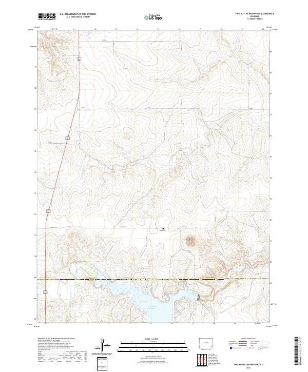
2022 Map of Two Buttes Reservoir
USGS Topo · Published 2022About this map
Two Buttes rises as the primary landmark in this section of the High Plains, overlooking a landscape defined by the intersection of the Prowers and Baca county lines. The geography is shaped by the drainage systems of Two Butte Creek and its tributaries, including N Butte Cr and S Mule Cr, which feed into the extensive Two Buttes Reservoir.
Find a feature on this map
27 named features on this map. Tap any name to fly to it.
Don’t see what you’re looking for? This feature index may not catch every label — zoom into the map to look around manually.
Map Details
Editions of this 2022 Two Buttes Reservoir Map
This is the sole edition of this map. No revisions or reprints were ever made.
Other maps of this area

1891 · Albany
USGS Topo · 1:125,000

1892 · Two Butte
USGS Topo · 1:125,000

1893 · Two Butte
USGS Topo · 1:125,000

1893 · Albany
USGS Topo · 1:125,000

1955 · La Junta
USGS Topo · 1:250,000

1958 · La Junta
USGS Topo · 1:250,000

1968 · La Junta
USGS Topo · 1:250,000
1968 · Cat Creek
USGS Topo · 1:24,000
1968 · Gobblers Knob
USGS Topo · 1:24,000
1968 · Barrel Spring
USGS Topo · 1:24,000