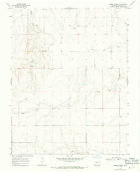
1968 Map of Barrel Spring
USGS Topo · Published 1971About this map
The Santa Fe Trail cuts a historic path across this high plains landscape in Prowers County, following the natural drainage of Granada Creek through the western section. Surveyed in the late 1960s, the map reveals a sparsely populated ranching territory defined by vital water sources like Barrel Spring and Blackwater Spring. The southern portion of the sheet features the Bethel Cem and the named area of Albany, providing key points of interest for genealogists tracing early families in this corner of Colorado. Multiple watercourses, including North Plum Creek, Middle Plum Creek, and Wolf Creek, carve through the terrain toward North Butte, illustrating the importance of riparian corridors for survival and settlement in the semi-arid environment.
Find a feature on this map
12 named features on this map. Tap any name to fly to it.
Don’t see what you’re looking for? This feature index may not catch every label — zoom into the map to look around manually.
Map Details
Editions of this 1968 Barrel Spring Map
This is the sole edition of this map. No revisions or reprints were ever made.
Other maps of this area

1891 · Albany
USGS Topo · 1:125,000

1892 · Two Butte
USGS Topo · 1:125,000

1893 · Two Butte
USGS Topo · 1:125,000

1893 · Albany
USGS Topo · 1:125,000

1955 · La Junta
USGS Topo · 1:250,000

1958 · La Junta
USGS Topo · 1:250,000

1968 · La Junta
USGS Topo · 1:250,000
1968 · North Plum Creek NE
USGS Topo · 1:24,000
1968 · Cat Creek NE
USGS Topo · 1:24,000
1968 · North Plum Creek SE
USGS Topo · 1:24,000