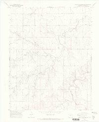
1968 Map of North Plum Creek SE
USGS Topo · Published 1971About this map
Plum Creek and its many branches define the topography of this Prowers County landscape in the late 1960s. The drainage network is intricately detailed, showing Middle Plum Creek, South Plum Creek, and Durkee Creek cutting through the terrain. Evidence of rural infrastructure is found at Union Sch and a nearby Radio Tower, while the local economy is represented by a Gravel Pit in the southern sections.
Find a feature on this map
14 named features on this map. Tap any name to fly to it.
Don’t see what you’re looking for? This feature index may not catch every label — zoom into the map to look around manually.
Map Details
Editions of this 1968 North Plum Creek SE Map
This is the sole edition of this map. No revisions or reprints were ever made.
Other maps of this area

1891 · Albany
USGS Topo · 1:125,000

1893 · Albany
USGS Topo · 1:125,000

1955 · La Junta
USGS Topo · 1:250,000

1958 · La Junta
USGS Topo · 1:250,000
1966 · Two Butte Springs
USGS Topo · 1:24,000
1966 · Durkee Creek NW
USGS Topo · 1:24,000

1968 · La Junta
USGS Topo · 1:250,000
1968 · North Plum Creek NE
USGS Topo · 1:24,000
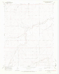
1968 · North Plum Creek NW
USGS Topo · 1:24,000
1968 · Barrel Spring
USGS Topo · 1:24,000