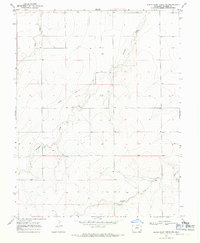
1968 Map of North Plum Creek NE
USGS Topo · Published 1971About this map
Santa Fe Granada Trail cuts across this Prowers County landscape, marking a historical route through a terrain defined by deep drainage systems. The survey, conducted in the late 1960s, highlights the intricate path of Granada Creek and Wolf Creek as they wind through the high plains toward the Arkansas River valley. The presence of Durkee and a localized Gravel Pit indicates a region utilized for transit and small-scale resource extraction. Unlike the flat expanses often associated with this part of Colorado, the map reveals a complex network of dry creek beds and draws, including Durkee Creek and Plum Creek, which suggest the seasonal water movement that shaped the cattle-ranching environment of the era. Benchmarks like BR 3615 and various wells provide precise data points for those tracing historical land use or topographic changes in the High Plains.
Find a feature on this map
10 named features on this map. Tap any name to fly to it.
Don’t see what you’re looking for? This feature index may not catch every label — zoom into the map to look around manually.
Map Details
Editions of this 1968 North Plum Creek NE Map
This is the sole edition of this map. No revisions or reprints were ever made.
Other maps of this area

1890 · Granada
USGS Topo · 1:125,000

1891 · Albany
USGS Topo · 1:125,000

1892 · Granada
USGS Topo · 1:125,000

1893 · Albany
USGS Topo · 1:125,000

1894 · Granada
USGS Topo · 1:125,000

1952 · Carlton
USGS Topo · 1:24,000

1953 · Holly West
USGS Topo · 1:24,000

1953 · Granada
USGS Topo · 1:24,000

1954 · Lamar
USGS Topo · 1:250,000

1955 · La Junta
USGS Topo · 1:250,000