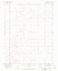
1968 Map of Cat Creek NE
USGS Topo · Published 1971About this map
Clay Creek Store stands as a primary landmark in this rural Prowers County landscape, reflecting the essential rural commerce of the late 1960s. The terrain is defined by the drainage patterns of Clay Creek and Horse Creek, which carve through the high plains toward the northeast. A notable infrastructure element is the Aqueduct, which cuts across the central sections of the quadrangle, illustrating the critical role of water management in this arid region. High points like Signal Hill 3990 provide topographic orientation for the area, while localized features such as a Radio Tower and the small marker at June indicate the sparse but intentional human imprint on the land. This survey, based on 1967 aerial photography and field-checked in 1968, captures the precise layout of section lines and unimproved roads that connected these remote points before the turn of the decade.
Find a feature on this map
9 named features on this map. Tap any name to fly to it.
Don’t see what you’re looking for? This feature index may not catch every label — zoom into the map to look around manually.
Map Details
Editions of this 1968 Cat Creek NE Map
This is the sole edition of this map. No revisions or reprints were ever made.
Other maps of this area

1890 · Granada
USGS Topo · 1:125,000

1891 · Albany
USGS Topo · 1:125,000

1892 · Lamar
USGS Topo · 1:125,000

1892 · Granada
USGS Topo · 1:125,000

1892 · Two Butte
USGS Topo · 1:125,000

1893 · Two Butte
USGS Topo · 1:125,000

1893 · Albany
USGS Topo · 1:125,000

1894 · Granada
USGS Topo · 1:125,000

1952 · Lamar West
USGS Topo · 1:24,000

1952 · Carlton
USGS Topo · 1:24,000