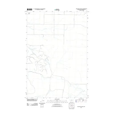
2011 Map of Two Pine School
USGS Topo · Published 2011About this map
Canyon Creek and its complex tributaries define this section of Yellowstone County as it appeared in the early 21st century. The map reveals a transition from a traditional grid of section-line roads in the north, such as McFarland Rd and Smith Rd, to a more modern residential development pattern in the south. This newer landscape is characterized by winding lanes and trails like Medicine Man Tl and Buffalo Jump Rd, which follow the contours of the drainage basin. Water management is a visible priority for the local acreage, evidenced by the F Downs Number 1 Dam in the northwest corner. The drainage network, including North Fork Canyon Creek and South Fork Canyon Creek, illustrates the natural pathways through this terrain before they converge toward the Yellowstone River valley south of this quadrangle.
Find a feature on this map
37 named features on this map. Tap any name to fly to it.
Don’t see what you’re looking for? This feature index may not catch every label — zoom into the map to look around manually.
Map Details
Editions of this 2011 Two Pine School Map
This is the sole edition of this map. No revisions or reprints were ever made.
Other maps of this area

1954 · Billings
USGS Topo · 1:250,000

1956 · Comanche
USGS Topo · 1:24,000

1956 · Acton
USGS Topo · 1:24,000

1956 · Molt
USGS Topo · 1:24,000

1956 · Rock Spring
USGS Topo · 1:24,000

1956 · Rimrock
USGS Topo · 1:24,000

1956 · Two Pine School
USGS Topo · 1:24,000

1956 · Laurel
USGS Topo · 1:24,000

1956 · Park City
USGS Topo · 1:24,000

1956 · Mossmain
USGS Topo · 1:24,000