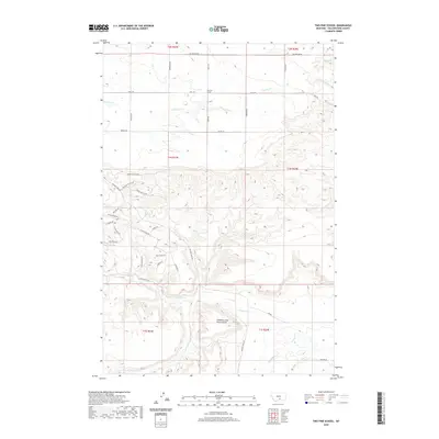
2020 Map of Two Pine School
USGS Topo · Published 2020About this map
Two Pine School stands at the intersection of Molt Rd and Jones Rd, serving as a central landmark in this portion of Yellowstone County. The landscape is defined by the complex drainage systems of Canyon Cr, which branches into the North Fork Canyon Creek and South Fork Canyon Creek. To the north, the terrain gives way to the headwaters of South Fork Alkali Creek and Dusty Creek. One of the most intriguing cultural markers on the map is the Calamity Jane Horse Cache, located near the southern bends of Canyon Cr. This label references local lore and the historical presence of frontier figures in the Montana territory. The map reveals a transition from a structured rural road grid in the north to the more winding, topographic-dependent trails and roads of the south, such as Buffalo Trail Rd and Mule Train Ln.
Find a feature on this map
43 named features on this map. Tap any name to fly to it.
Don’t see what you’re looking for? This feature index may not catch every label — zoom into the map to look around manually.
Map Details
Editions of this 2020 Two Pine School Map
This is the sole edition of this map. No revisions or reprints were ever made.
Other maps of this area

1954 · Billings
USGS Topo · 1:250,000

1956 · Comanche
USGS Topo · 1:24,000

1956 · Acton
USGS Topo · 1:24,000

1956 · Molt
USGS Topo · 1:24,000

1956 · Rock Spring
USGS Topo · 1:24,000

1956 · Rimrock
USGS Topo · 1:24,000

1956 · Two Pine School
USGS Topo · 1:24,000

1956 · Laurel
USGS Topo · 1:24,000

1956 · Park City
USGS Topo · 1:24,000

1956 · Mossmain
USGS Topo · 1:24,000