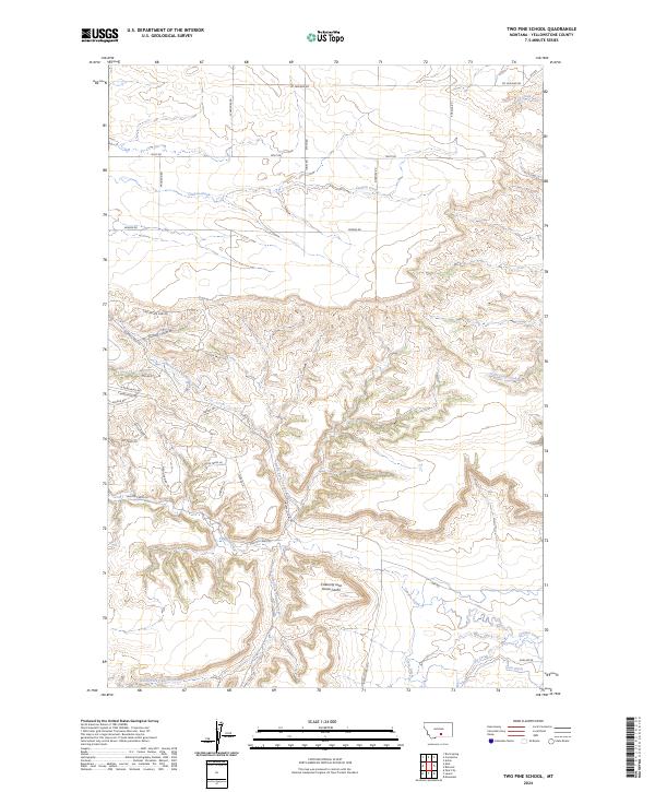
2024 Map of Two Pine School
USGS Topo · Published 2024About this map
The rugged topography of Yellowstone County, Montana, is defined here by the intricate drainages of Canyon Creek and its major tributaries. The landscape is marked by a distinctive transition from the plateau-like terrain near Molt Rd in the north to the more complex branching of the North Fork Canyon Creek and South Fork Canyon Creek. Of particular interest to local historians and folklorists is the Calamity Jane Horse-Cache, a site name that ties the physical landscape to the regional lore of the Old West. Modern development and access are traced through a network of roads and trails with names that evoke the frontier past, such as Medicine Man Trl, Mule Train Ln, and Sands Trl. The map also documents water management in this arid environment, featuring the Cove Ditch and its relation to the surrounding creek systems.
Find a feature on this map
42 named features on this map. Tap any name to fly to it.
Don’t see what you’re looking for? This feature index may not catch every label — zoom into the map to look around manually.
Map Details
Editions of this 2024 Two Pine School Map
This is the sole edition of this map. No revisions or reprints were ever made.
Other maps of this area

1954 · Billings
USGS Topo · 1:250,000

1956 · Comanche
USGS Topo · 1:24,000

1956 · Acton
USGS Topo · 1:24,000

1956 · Molt
USGS Topo · 1:24,000

1956 · Rock Spring
USGS Topo · 1:24,000

1956 · Rimrock
USGS Topo · 1:24,000

1956 · Two Pine School
USGS Topo · 1:24,000

1956 · Laurel
USGS Topo · 1:24,000

1956 · Park City
USGS Topo · 1:24,000

1956 · Mossmain
USGS Topo · 1:24,000