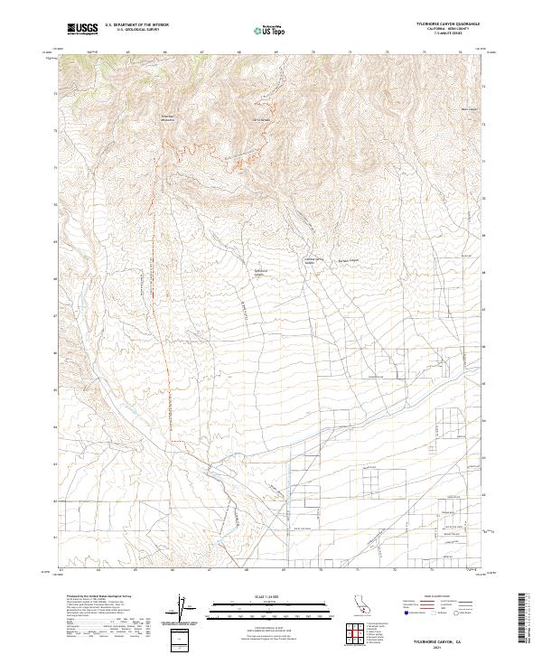
2021 Map of Tylerhorse Canyon
USGS Topo · Published 2021About this map
The Tehachapi Mountains and the Sierra Nevada converge in this transition between mountain and high desert, marked by the dramatic descent of Tylerhorse Canyon and Gamble Spring Canyon. Modern infrastructure dominates the lower elevations, where the Los Angeles Aqueduct and Second Los Angeles Aqueduct traverse the arid landscape alongside Cottonwood Cr. The map captures a moment of intense recreational and utility-based land use, with the Pacific Crest National Scenic Trail winding through the peaks above a grid of desert roads like Ave of the Stars and Dirtbiker Shack Rd. This juxtaposition of vital water engineering and rugged terrain reflects the ongoing evolution of Kern County's utility corridors and backcountry access.
Find a feature on this map
32 named features on this map. Tap any name to fly to it.
Don’t see what you’re looking for? This feature index may not catch every label — zoom into the map to look around manually.
Map Details
Editions of this 2021 Tylerhorse Canyon Map
This is the sole edition of this map. No revisions or reprints were ever made.
Other maps of this area

1903 · Tejon
USGS Topo · 1:125,000

1914 · Caliente
USGS Topo · 1:125,000

1915 · Elizabeth Lake
USGS Topo · 1:125,000

1915 · Mojave
USGS Topo · 1:125,000

1917 · Elizabeth Lake
USGS Topo · 1:125,000

1943 · Tehachapi
USGS Topo · 1:62,500

1943 · Cummings Mountain
USGS Topo · 1:62,500

1943 · Neenach
USGS Topo · 1:62,500

1943 · Willow Springs
USGS Topo · 1:62,500

1948 · Bakersfield
USGS Topo · 1:250,000