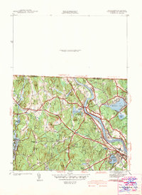
1942 Map of Tyngsboro
USGS Topo · Published 1942About this map
The Merrimack River carves a dramatic oxbow through this landscape, defining the character of Tyngsboro and the surrounding borderlands of Middlesex County during the late 1930s. The river is a focal point for recreation and industry, featuring the Vesper Country Club on Tyngs Island and the prominent Boston and Maine Railroad tracking its western bank. The settlement pattern is characterized by numerous family-named crossroads such as Frederick Corner, Swan Corner, and Whidden Corner, which suggest a deeply rooted local genealogy.
Find a feature on this map
72 named features on this map. Tap any name to fly to it.
Don’t see what you’re looking for? This feature index may not catch every label — zoom into the map to look around manually.
Map Details
Editions of this 1942 Tyngsboro Map
This is the sole edition of this map. No revisions or reprints were ever made.
Other maps of this area

1886 · Lowell
USGS Topo · 1:62,500

1893 · Lowell
USGS Topo · 1:62,500

1893 · Groton
USGS Topo · 1:62,500

1905 · Manchester
USGS Topo · 1:62,500

1906 · Milford
USGS Topo · 1:62,500

1918 · Lowell
USGS Topo · 1:62,500

1921 · Lowell
USGS Topo · 1:62,500

1931 · Lowell
USGS Topo · 1:48,000

1931 · Groton
USGS Topo · 1:48,000

1935 · Ayer
USGS Topo · 1:24,000