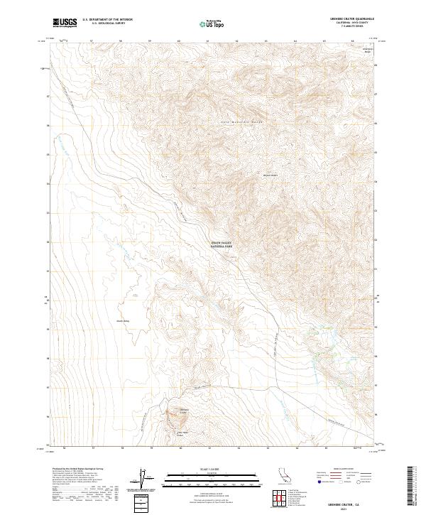
2021 Map of Ubehebe Crater
USGS Topo · Published 2021About this map
Ubehebe Crater and its smaller neighbor, Little Hebe Crater, dominate the southern landscape of this Inyo County survey within Death Valley National Park. The volcanic features are reached via the junction of Ubehebe Crater Road and Racetrack Valley Road, providing a glimpse into the geological activity that shaped this portion of the Mojave Desert.
Find a feature on this map
19 named features on this map. Tap any name to fly to it.
Don’t see what you’re looking for? This feature index may not catch every label — zoom into the map to look around manually.
Map Details
Editions of this 2021 Ubehebe Crater Map
This is the sole edition of this map. No revisions or reprints were ever made.
Other maps of this area

1908 · Lida
USGS Topo · 1:250,000

1908 · Ballarat
USGS Topo · 1:250,000

1913 · Lida
USGS Topo · 1:250,000

1913 · Ballarat
USGS Topo · 1:250,000

1948 · Death Valley
USGS Topo · 1:250,000

1954 · Death Valley
USGS Topo · 1:250,000

1954 · Goldfield
USGS Topo · 1:250,000

1955 · Goldfield
USGS Topo · 1:250,000

1956 · Death Valley
USGS Topo · 1:250,000

1957 · Death Valley
USGS Topo · 1:250,000