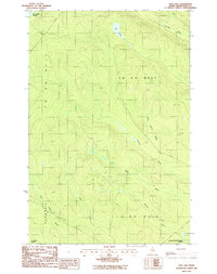
1986 Map of Ugh Lake
USGS Topo · Published 1987About this map
The St John River defines the northwestern corner of this remote Maine landscape, where the traditional land divisions of T 12 R 15 W E L S and T 11 R 14 W E L S meet. This 1980s survey illustrates a region dominated by a complex network of waterways, centered on the aptly named Ugh Lake and the smaller Agnes Pond. These water bodies feed into a dense system of drainages, including Cunliffe Brook and Holmes Brook, which eventually contribute to the Chemquasabamticook Stream in the southeast.
Find a feature on this map
16 named features on this map. Tap any name to fly to it.
Don’t see what you’re looking for? This feature index may not catch every label — zoom into the map to look around manually.
Map Details
Editions of this 1986 Ugh Lake Map
This is the sole edition of this map. No revisions or reprints were ever made.
Other maps of this area

1932 · Umsaskis Lake
USGS Topo · 1:48,000

1935 · Umsaskis Lake
USGS Topo · 1:62,500

1954 · Presque Isle
USGS Topo · 1:250,000

1955 · Round Pond
USGS Topo · 1:62,500

1955 · Clayton Lake
USGS Topo · 1:62,500

1955 · Seven Islands
USGS Topo · 1:62,500

1958 · Presque Isle
USGS Topo · 1:250,000

1960 · Presque Isle
USGS Topo · 1:250,000

1976 · Seven Islands
USGS Topo · 1:24,000
1977 · Houlton Pond
USGS Topo · 1:24,000