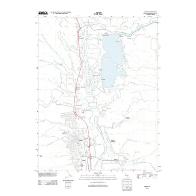
2012 Map of Ukiah
USGS Topo · Published 2012About this map
Lake Mendocino dominates the northern landscape of this Mendocino County survey, where the Russian River flows south through a series of valley settlements. The city of Ukiah serves as the central hub, supported by peripheral communities like Calpella, Presswood, and Talmage. Notable landmarks provide insight into the region's development and public works, including the Ukiah Municipal Gas Works and the Asylum located south of the main city center. Local history is further preserved through legacy sites like the Ukiah Cemetery and the Vichy Springs resort area to the east.
Find a feature on this map
108 named features on this map. Tap any name to fly to it.
Don’t see what you’re looking for? This feature index may not catch every label — zoom into the map to look around manually.
Map Details
Editions of this 2012 Ukiah Map
This is the sole edition of this map. No revisions or reprints were ever made.
Other maps of this area

1920 · Ukiah
USGS Topo · 1:62,500

1922 · Willits
USGS Topo · 1:62,500

1942 · Willits
USGS Topo · 1:62,500

1943 · Pomo
USGS Topo · 1:62,500

1943 · Boonville
USGS Topo · 1:62,500

1944 · Ukiah
USGS Topo · 1:62,500

1944 · Willits
USGS Topo · 1:62,500

1957 · Ukiah
USGS Topo · 1:250,000
1958 · Purdys Gardens
USGS Topo · 1:24,000

1958 · Ukiah
USGS Topo · 1:24,000