2022 Map of Ukiah
USGS Topo · Published 2022About this map
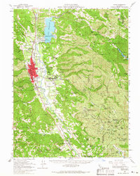
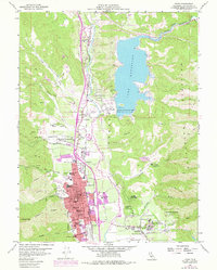
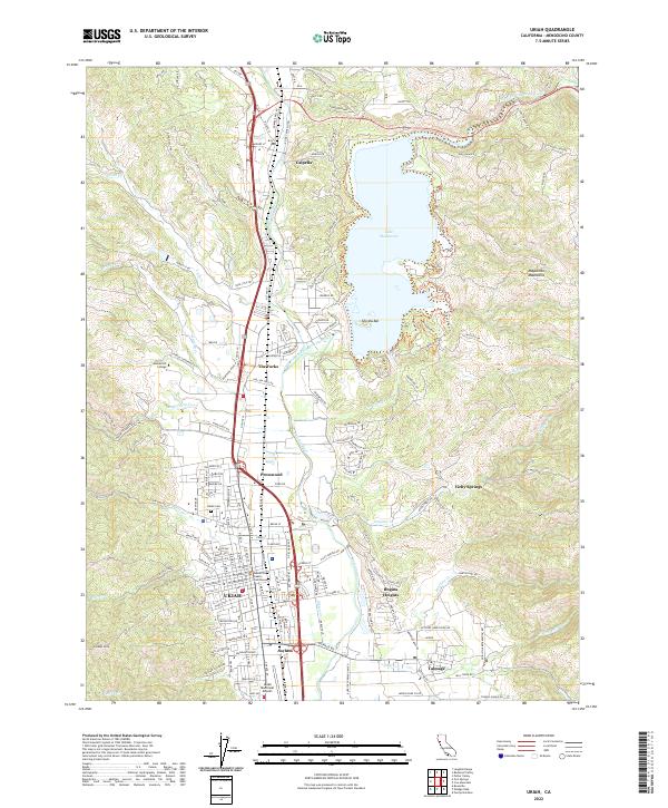
Ukiah serves as the central hub of this northern California landscape, where the Russian River flows southward through a wide valley flanked by the Mayacmas Mountains. The map reveals a dense network of suburban development and historical landmarks, including the Mendocino County Courthouse and the extensive grounds of the Asylum south of the city center. To the north, the impounded waters of Lake Mendocino dominate the geography, created where the East Fork Russian River is dammed near The Forks.
Find a feature on this map
168 named features on this map. Tap any name to fly to it.
Don’t see what you’re looking for? This feature index may not catch every label — zoom into the map to look around manually.
Map Details
Editions of this 2022 Ukiah Map
This is the sole edition of this map. No revisions or reprints were ever made.
Historical Maps of Talmage Through Time
8 maps found