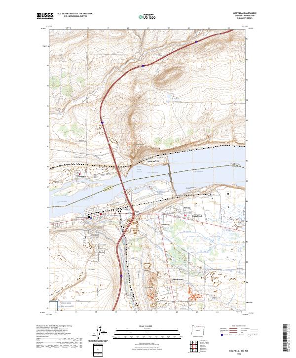
2024 Map of Umatilla
USGS Topo · Published 2024About this map
Umatilla and its surrounding communities sit at a critical hydrological junction where the Umatilla River joins the Columbia River, creating a landscape defined by water management and transit. The area is partitioned by massive reservoirs, including Lake Wallula and Lake Umatilla, which are linked by the McNary Range Channel. On the Washington side, the settlement of Plymouth overlooks the water, while the Oregon shore is a complex network of industrial and residential zones like Power City, McNary, and Charlestown. The reliance on irrigation is evident in the sprawling reach of the West Extension Irrigation Canal, the Brownell Ditch, and various laterals such as the OA Lateral and OB Lateral. Local history is anchored by the Pioneer Memorial Cem and Sunset Hills Cem, while the rugged geography is marked by prominent elevations like Sillusi Butte and Umatilla Butte.
Find a feature on this map
85 named features on this map. Tap any name to fly to it.
Don’t see what you’re looking for? This feature index may not catch every label — zoom into the map to look around manually.
Map Details
Editions of this 2024 Umatilla Map
This is the sole edition of this map. No revisions or reprints were ever made.
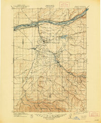
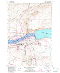
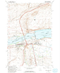
Historical Maps of Umatilla Through Time
4 maps found