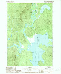
1988 Map of Umbagog Lake North
USGS Topo · Published 1988About this map
The confluence of the Magalloway River and Umbagog Lake defines this borderland landscape between New Hampshire and Maine. In the late 1980s, the small settlement of Wentworth Location remained a primary focal point, situated near a Landing Strip and a Cem. The map reveals a complex waterway system where the Androscoggin River meets the lake's western shore at Sweat Meadows, while the Rapid R enters from the east. The terrain is characterized by massive timber management areas and remote grants, such as the Second College Grant and Magalloway Plantation. Prominent peaks like Mt Dustan and Sturtevant Mountain overlook a network of smaller ponds including Dustan Pond and Sturtevant Pond. The presence of landmarks like Molls Rock and Pine Point along the lake shoreline highlights the area's importance for local navigation and recreational geography.
Find a feature on this map
45 named features on this map. Tap any name to fly to it.
Don’t see what you’re looking for? This feature index may not catch every label — zoom into the map to look around manually.
Map Details
Editions of this 1988 Umbagog Lake North Map
This is the sole edition of this map. No revisions or reprints were ever made.
Other maps of this area

1930 · Milan
USGS Topo · 1:62,500

1930 · Errol
USGS Topo · 1:62,500

1933 · Milan
USGS Topo · 1:62,500

1934 · Errol
USGS Topo · 1:62,500

1934 · Milan
USGS Topo · 1:62,500

1940 · Oquossoc
USGS Topo · 1:62,500

1942 · Oquossoc
USGS Topo · 1:62,500

1943 · Old Speck Mtn
USGS Topo · 1:62,500

1945 · Old Speck Mtn
USGS Topo · 1:62,500

1950 · Lewiston
USGS Topo · 1:250,000