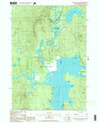
1995 Map of Umbagog Lake North
USGS Topo · Published 2000About this map
Lake Umbagog National Wildlife Refuge dominates this wilderness landscape along the border of New Hampshire and Maine. The water system here is complex, characterized by the convergence of the Magalloway River and the Diamond River, which feed into the expansive Lake Umbagog. Historically, these waterways served as critical transit corridors for the regional timber industry. The map captures a moment when conservation and administrative boundaries define the terrain, from the Second College Grant in the north to the Umbagog State Park further south.
Find a feature on this map
48 named features on this map. Tap any name to fly to it.
Don’t see what you’re looking for? This feature index may not catch every label — zoom into the map to look around manually.
Map Details
Editions of this 1995 Umbagog Lake North Map
This is the sole edition of this map. No revisions or reprints were ever made.
Other maps of this area

1930 · Milan
USGS Topo · 1:62,500

1930 · Errol
USGS Topo · 1:62,500

1933 · Milan
USGS Topo · 1:62,500

1934 · Errol
USGS Topo · 1:62,500

1934 · Milan
USGS Topo · 1:62,500

1940 · Oquossoc
USGS Topo · 1:62,500

1942 · Oquossoc
USGS Topo · 1:62,500

1943 · Old Speck Mtn
USGS Topo · 1:62,500

1945 · Old Speck Mtn
USGS Topo · 1:62,500

1950 · Lewiston
USGS Topo · 1:250,000