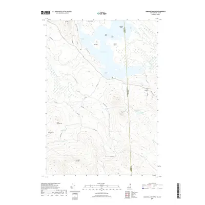
2018 Map of Umbagog Lake South
USGS Topo · Published 2018About this map
Umbagog Lake straddles the border between Coos County, New Hampshire and Oxford County, Maine, anchoring a landscape of glacial waters and high summits. The settlement of Upton sits on the eastern edge of the sheet, where Mill Hill Rd and Barnes Rd provide access to the surrounding hills. To the south and west, the terrain rises sharply toward Cambridge Black Mtn and Little Roundtop Mtn, forming a watershed that feeds into Mollidgewock Brook and Mollidgewock Pond.
Find a feature on this map
41 named features on this map. Tap any name to fly to it.
Don’t see what you’re looking for? This feature index may not catch every label — zoom into the map to look around manually.
Map Details
Editions of this 2018 Umbagog Lake South Map
This is the sole edition of this map. No revisions or reprints were ever made.
Other maps of this area

1930 · Milan
USGS Topo · 1:62,500

1930 · Errol
USGS Topo · 1:62,500

1933 · Milan
USGS Topo · 1:62,500

1934 · Errol
USGS Topo · 1:62,500

1934 · Milan
USGS Topo · 1:62,500

1940 · Oquossoc
USGS Topo · 1:62,500

1942 · Oquossoc
USGS Topo · 1:62,500

1943 · Old Speck Mtn
USGS Topo · 1:62,500

1945 · Old Speck Mtn
USGS Topo · 1:62,500

1950 · Lewiston
USGS Topo · 1:250,000