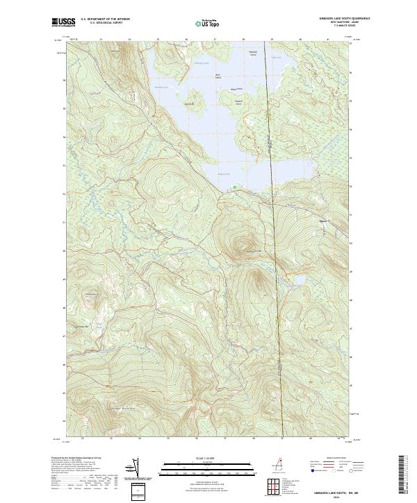
2024 Map of Umbagog Lake South
USGS Topo · Published 2024About this map
Umbagog Lake and the surrounding wilderness of northern Coos County define this 2024 survey, which tracks the intersection of protected lands and rugged topography along the New Hampshire and Maine border. Much of the northern terrain is preserved within the Umbagog National Wildlife Refuge, encompassing significant water features like Thurston Cove, Sargent Cove, and the prominent Big Island. The map records the sparse settlement of Upton on the eastern edge, where the road network including Mill Hill Rd and Barnes Rd transitions into the high elevations of the Hampshire Hills.
Find a feature on this map
45 named features on this map. Tap any name to fly to it.
Don’t see what you’re looking for? This feature index may not catch every label — zoom into the map to look around manually.
Map Details
Editions of this 2024 Umbagog Lake South Map
This is the sole edition of this map. No revisions or reprints were ever made.
Other maps of this area

1930 · Milan
USGS Topo · 1:62,500

1930 · Errol
USGS Topo · 1:62,500

1933 · Milan
USGS Topo · 1:62,500

1934 · Errol
USGS Topo · 1:62,500

1934 · Milan
USGS Topo · 1:62,500

1940 · Oquossoc
USGS Topo · 1:62,500

1942 · Oquossoc
USGS Topo · 1:62,500

1943 · Old Speck Mtn
USGS Topo · 1:62,500

1945 · Old Speck Mtn
USGS Topo · 1:62,500

1950 · Lewiston
USGS Topo · 1:250,000