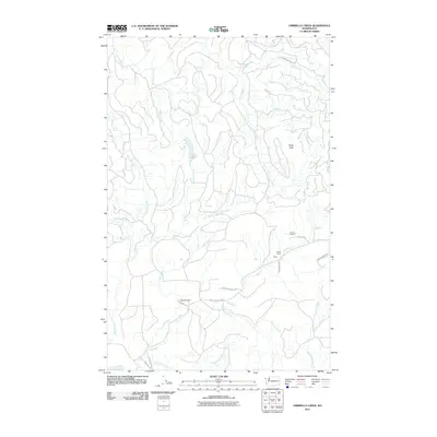
2011 Map of Umbrella Creek
USGS Topo · Published 2011About this map
The Big River and Umbrella Creek drainage systems define this section of Clallam County, where the dense coastal forests meet established family landholdings. Local settlement is concentrated around named homesteads such as Iverson Ranch, Person Ranch, and Wesseler Ranch, clustered primarily near the river valleys and the small community of Royal. The landscape is dominated by the transition from managed lands to protected wilderness, as significant portions of the terrain fall within the boundaries of Olympic National Park.
Find a feature on this map
24 named features on this map. Tap any name to fly to it.
Don’t see what you’re looking for? This feature index may not catch every label — zoom into the map to look around manually.
Map Details
Editions of this 2011 Umbrella Creek Map
This is the sole edition of this map. No revisions or reprints were ever made.
Other maps of this area

1935 · Clallam
USGS Topo · 1:62,500

1935 · Ozette Lake
USGS Topo · 1:62,500

1935 · Lake Pleasant
USGS Topo · 1:62,500

1938 · Cape Flattery
USGS Topo · 1:62,500

1942 · Clallam
USGS Topo · 1:62,500

1942 · Ozette Lake
USGS Topo · 1:62,500

1942 · Lake Pleasant
USGS Topo · 1:62,500

1953 · Cape Flattery
USGS Topo · 1:250,000

1956 · Ozette Lake
USGS Topo · 1:62,500

1957 · Lake Pleasant
USGS Topo · 1:62,500