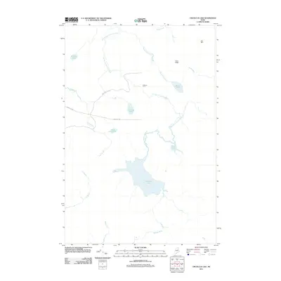
2011 Map of Umcolcus Lake
USGS Topo · Published 2011About this map
Umcolcus Lake dominates the central landscape of this remote Maine territory, serving as the hydrological hub for a network of waterways including Weeks Brook and Wadleigh Brook. This 2011 survey documents a sparsely populated timber and recreation area, defined by the winding course of the East Branch Umcolcus Stream and high points like Yerxa Ridge.
Find a feature on this map
19 named features on this map. Tap any name to fly to it.
Don’t see what you’re looking for? This feature index may not catch every label — zoom into the map to look around manually.
Map Details
Editions of this 2011 Umcolcus Lake Map
This is the sole edition of this map. No revisions or reprints were ever made.
Other maps of this area

1940 · Island Falls
USGS Topo · 1:62,500

1940 · Oxbow
USGS Topo · 1:62,500

1942 · Island Falls
USGS Topo · 1:62,500

1942 · Oxbow
USGS Topo · 1:62,500

1954 · Shin Pond
USGS Topo · 1:62,500

1954 · Grand Lake Seboeis
USGS Topo · 1:62,500

1954 · Presque Isle
USGS Topo · 1:250,000

1958 · Presque Isle
USGS Topo · 1:250,000

1960 · Presque Isle
USGS Topo · 1:250,000
1965 · Oxbow
USGS Topo · 1:62,500