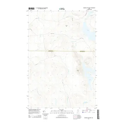
2014 Map of Umsaskis Lake West
USGS Topo · Published 2014About this map
Umsaskis Lake and the surrounding wilderness of Northern Maine define this landscape within the North Maine Woods. This area, spanning the border of Aroostook and Piscataquis counties, is characterized by its network of logging roads and drainages. Prominent peaks including Squirrel Mtn and Priestly Mtn rise above the interconnected waterways of Priestly Brook, Drake Brook, and the various branches of Middle Br Thoroughfare Brook. This interior timberland is navigated via established routes such as Churchill Dam Rd, Poulin Rd, and the uniquely named Reality Rd. These roads provide the primary access to remote water bodies like Priestly Lake and Little Churchill Pond, which are central to the region's long-standing connection to the forestry industry and outdoor recreation.
Find a feature on this map
19 named features on this map. Tap any name to fly to it.
Don’t see what you’re looking for? This feature index may not catch every label — zoom into the map to look around manually.
Map Details
Editions of this 2014 Umsaskis Lake West Map
This is the sole edition of this map. No revisions or reprints were ever made.
Other maps of this area

1932 · Umsaskis Lake
USGS Topo · 1:48,000

1935 · Umsaskis Lake
USGS Topo · 1:62,500

1954 · Churchill Lake
USGS Topo · 1:62,500

1954 · Allagash Lake
USGS Topo · 1:62,500

1954 · Presque Isle
USGS Topo · 1:250,000

1955 · Clayton Lake
USGS Topo · 1:62,500

1958 · Presque Isle
USGS Topo · 1:250,000

1960 · Presque Isle
USGS Topo · 1:250,000

1961 · Allagash Lake
USGS Topo · 1:62,500
1962 · Churchill Lake
USGS Topo · 1:62,500