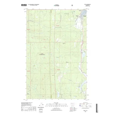
2020 Map of Uncas
USGS Topo · Published 2020About this map
Uncas sits at the southern tip of Discovery Bay, serving as a focal point for this Olympic Peninsula corridor where timberlands meet the water. The landscape transitions from the coastal settlement at Discovery Junction and Maynard into the dense reaches of the Olympic National Forest. To the south, the communities of Leland and the surrounding area are defined by a series of freshwater bodies, including Leland Lake, Crocker Lake, and Lords Lake. The rugged interior is marked by significant elevations like Big Skidder Hill and Little Skidder Hill, while the Pacific NW National Scenic Trail winds through the northern hills. Numerous drainages such as Snow Creek and Salmon Creek carve through the forest, illustrating the complex hydrology that supported early settlement and resource extraction in Jefferson County.
Find a feature on this map
63 named features on this map. Tap any name to fly to it.
Don’t see what you’re looking for? This feature index may not catch every label — zoom into the map to look around manually.
Map Details
Editions of this 2020 Uncas Map
This is the sole edition of this map. No revisions or reprints were ever made.
Other maps of this area

1938 · Mt Constance
USGS Topo · 1:125,000

1938 · Dungeness
USGS Topo · 1:62,500

1939 · Port Townsend
USGS Topo · 1:62,500

1939 · Dungeness
USGS Topo · 1:62,500

1940 · Quilcene
USGS Topo · 1:62,500

1946 · Tyler Peak
USGS Topo · 1:62,500

1948 · Tyler Peak
USGS Topo · 1:62,500

1953 · Quilcene
USGS Topo · 1:24,000

1953 · Mt. Walker
USGS Topo · 1:24,000

1953 · Center
USGS Topo · 1:24,000