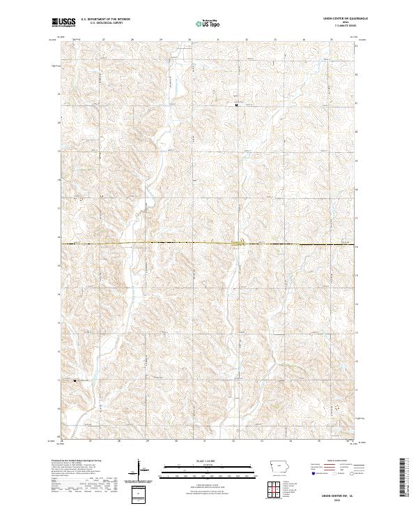
2022 Map of Union Center SW
USGS Topo · Published 2022About this map
The county boundary between Plymouth Co and Woodbury Co bisects this Iowa landscape, where a grid of rural roads defines the agricultural character of the region. Local heritage is preserved at sites like Lincoln Cem in the north and Concordia Cem further south, providing essential landmarks for genealogical research. The terrain is deeply carved by a network of drainage ways, including Big Whisky Cr, Muddy Cr, and Elliott Cr, which dictate the placement of farmsteads and the winding paths of secondary routes such as Co Rd C70. This modern record of the area reflects a deeply rooted township-and-range system that has remained consistent for over a century, while also documenting the current infrastructure of county highways like Co Hwy D18.
Find a feature on this map
35 named features on this map. Tap any name to fly to it.
Don’t see what you’re looking for? This feature index may not catch every label — zoom into the map to look around manually.
Map Details
Editions of this 2022 Union Center SW Map
This is the sole edition of this map. No revisions or reprints were ever made.
Other maps of this area

1955 · Sioux City
USGS Topo · 1:250,000

1958 · Sioux City
USGS Topo · 1:250,000

1959 · Sioux City
USGS Topo · 1:250,000

1962 · Union Center
USGS Topo · 1:62,500

1964 · Sergeant Bluff
USGS Topo · 1:24,000

1964 · James
USGS Topo · 1:24,000

1964 · Hinton
USGS Topo · 1:24,000

1964 · Lawton
USGS Topo · 1:24,000

1964 · Moville
USGS Topo · 1:24,000
1985 · Union Center
USGS Topo · 1:24,000