
1964 Map of Hinton
USGS Topo · Published 1965About this map
The Floyd River corridor in Plymouth County is defined by a dense intersection of rail and river commerce during the mid-1960s. Two major rail lines, the Chicago and North Western and the Illinois Central, parallel the river's winding course, connecting the agricultural hubs of Merrill and Hinton. This map captures a landscape of established rural communities, marked by institutional anchors like St Paul Ch and Liberty Sch. In the western portion, the deeply incised drainage of Perry Creek contrasts with the broader floodplain of the Floyd. Genealogists can find significant detail in the placement of religious sites and burial grounds, including the St Joseph Cem near its namesake church and the Melbourne Cem in the southeastern corner. The transition from the rugged bluffs of Liberty township to the river bottomlands highlights the geographic factors that dictated early settlement patterns in this part of Iowa.
Find a feature on this map
21 named features on this map. Tap any name to fly to it.
Don’t see what you’re looking for? This feature index may not catch every label — zoom into the map to look around manually.
Map Details
Editions of this 1964 Hinton Map
This is the sole edition of this map. No revisions or reprints were ever made.
Other maps of this area

1955 · Sioux City
USGS Topo · 1:250,000

1958 · Sioux City
USGS Topo · 1:250,000

1959 · Sioux City
USGS Topo · 1:250,000

1962 · Le Mars
USGS Topo · 1:62,500

1962 · Union Center
USGS Topo · 1:62,500

1963 · Sioux City North
USGS Topo · 1:24,000

1964 · James
USGS Topo · 1:24,000
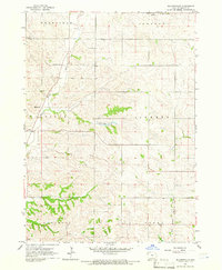
1964 · Millnerville
USGS Topo · 1:24,000
1969 · Brunsville
USGS Topo · 1:24,000
1969 · Ireton SW
USGS Topo · 1:24,000