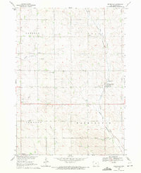
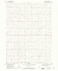
1969 Map of Brunsville
USGS Topo · Published 1971About this map
Brunsville serves as the primary hub of this Plymouth County landscape, situated where the Chicago and North Western rail line cuts through the prairie. The surrounding township divisions of Preston, Grant, Johnson, and Washington reveal a rural infrastructure built around localized community centers. Notable religious and commemorative landmarks like Christ Ch, First Plymouth Ch, and St Peters Cem are dispersed across the terrain, reflecting the early social fabric of these farming townships. The drainage of the land is defined by the winding paths of Mink Creek, Kettle Creek, and Bull Run, which carve distinct patterns into the agricultural grid. A Radio Tower and electrical Substation mark the gradual introduction of mid-century utility infrastructure into this traditionally agrarian corner of northwest Iowa.
Find a feature on this map
17 named features on this map. Tap any name to fly to it.
Don’t see what you’re looking for? This feature index may not catch every label — zoom into the map to look around manually.
Map Details
Editions of this 1969 Brunsville Map
This is the sole edition of this map. No revisions or reprints were ever made.
Other maps of this area

1955 · Sioux City
USGS Topo · 1:250,000

1958 · Sioux City
USGS Topo · 1:250,000

1959 · Sioux City
USGS Topo · 1:250,000

1962 · Le Mars
USGS Topo · 1:62,500

1962 · Union Center
USGS Topo · 1:62,500

1964 · Hinton
USGS Topo · 1:24,000
1964 · Millnerville
USGS Topo · 1:24,000
1969 · Ireton
USGS Topo · 1:24,000
1969 · Hawarden South
USGS Topo · 1:24,000
1969 · Ireton SW
USGS Topo · 1:24,000