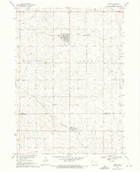
1969 Map of Ireton
USGS Topo · Published 1971About this map
Ireton and Craig serve as the primary hubs in this agricultural landscape of northwest Iowa during the late 1960s. The regional connectivity is defined by the Chicago and North Western railroad, which cuts a diagonal path through the prairie, linking the smaller settlements to larger markets. This survey highlights the established community infrastructure common to Sioux and Plymouth counties, where local life centered around rural landmarks like St Johns Ch and several well-maintained burial grounds including Pleasant Hill Cem and Dunkard Cem.
Find a feature on this map
19 named features on this map. Tap any name to fly to it.
Don’t see what you’re looking for? This feature index may not catch every label — zoom into the map to look around manually.
Map Details
Editions of this 1969 Ireton Map
This is the sole edition of this map. No revisions or reprints were ever made.
Other maps of this area

1955 · Sioux City
USGS Topo · 1:250,000

1955 · Sioux Falls
USGS Topo · 1:250,000

1958 · Sioux City
USGS Topo · 1:250,000

1958 · Sioux Falls
USGS Topo · 1:250,000

1959 · Sioux City
USGS Topo · 1:250,000

1962 · Le Mars
USGS Topo · 1:62,500

1964 · Sioux Center
USGS Topo · 1:24,000
1968 · Hawarden North
USGS Topo · 1:24,000

1968 · Labanon
USGS Topo · 1:24,000
1969 · Brunsville
USGS Topo · 1:24,000