
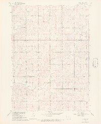
1968 Map of Labanon
USGS Topo · Published 1971About this map
Lebanon serves as the focal point of this agricultural landscape in Sioux County during the late 1960s. Situated atop the Garfield Plateau, the terrain is defined by the drainage patterns of Dry Creek and Sixmile Creek, which carve through the land between the townships of Garfield and Center. This survey, part of a program for the Missouri River Basin development, illustrates the rural infrastructure that supported local life, including the Peace Ch and the centrally located Townhall. Genealogists and local historians can find precise locations for several community markers, such as the Highland Cem near the western edge of the quadrangle. The map's detail extends to the technical, showing a Substation and a network of field lines that reveal the organization of Iowa farmsteads at this time.
Find a feature on this map
10 named features on this map. Tap any name to fly to it.
Don’t see what you’re looking for? This feature index may not catch every label — zoom into the map to look around manually.
Map Details
Editions of this 1968 Labanon Map
2 editions found
Other maps of this area

1955 · Sioux City
USGS Topo · 1:250,000

1955 · Sioux Falls
USGS Topo · 1:250,000

1958 · Sioux City
USGS Topo · 1:250,000

1958 · Sioux Falls
USGS Topo · 1:250,000

1959 · Sioux City
USGS Topo · 1:250,000

1962 · Le Mars
USGS Topo · 1:62,500

1964 · Sioux Center
USGS Topo · 1:24,000

1964 · Hull
USGS Topo · 1:24,000
1968 · Hawarden North
USGS Topo · 1:24,000

1968 · Fairview
USGS Topo · 1:24,000