
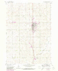
1964 Map of Sioux Center
USGS Topo · Published 1966About this map
Sioux Center serves as the focal point of this Northwest Iowa landscape, established as a concentrated hub of commerce and education amidst the surrounding township divisions. The presence of Dordt College and Kinsey Sch reflects the community's early investment in institutional growth during the mid-1960s. The town's grid is oriented along the Great Northern railroad, which provided the essential transport link for the region's agricultural output.
Find a feature on this map
12 named features on this map. Tap any name to fly to it.
Don’t see what you’re looking for? This feature index may not catch every label — zoom into the map to look around manually.
Map Details
Editions of this 1964 Sioux Center Map
2 editions found
Other maps of this area

1955 · Sioux City
USGS Topo · 1:250,000

1955 · Sioux Falls
USGS Topo · 1:250,000

1958 · Sioux City
USGS Topo · 1:250,000

1958 · Sioux Falls
USGS Topo · 1:250,000

1959 · Sioux City
USGS Topo · 1:250,000

1962 · Le Mars
USGS Topo · 1:62,500

1964 · Orange City
USGS Topo · 1:24,000

1964 · Boyden
USGS Topo · 1:24,000

1964 · Hull
USGS Topo · 1:24,000

1968 · Labanon
USGS Topo · 1:24,000