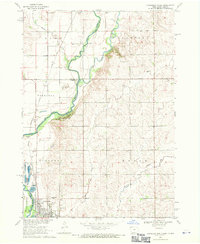
1968 Map of Hawarden North
USGS Topo · Published 1971About this map
The Big Sioux River forms a winding natural border between Iowa and South Dakota, anchoring a landscape defined by its river-and-rail connectivity in the late 1960s. The town of Hawarden serves as the local hub, situated at the confluence of the Chicago and North Western and Milwaukee Road railways. This rail intersection highlights the area's historical role as a regional transport corridor. To the north, the Rock River joins the Big Sioux near Oak Grove State Park, where the terrain transitions from cultivated plains to the wooded bluffs of the river valley.
Find a feature on this map
21 named features on this map. Tap any name to fly to it.
Don’t see what you’re looking for? This feature index may not catch every label — zoom into the map to look around manually.
Map Details
Editions of this 1968 Hawarden North Map
This is the sole edition of this map. No revisions or reprints were ever made.
Other maps of this area

1897 · Canton
USGS Topo · 1:125,000

1898 · Elk Point
USGS Topo · 1:125,000

1900 · Canton
USGS Topo · 1:125,000

1901 · Elk Point
USGS Topo · 1:125,000

1907 · Elk Point
USGS Topo · 1:125,000

1955 · Sioux City
USGS Topo · 1:250,000

1955 · Sioux Falls
USGS Topo · 1:250,000

1958 · Sioux City
USGS Topo · 1:250,000

1958 · Sioux Falls
USGS Topo · 1:250,000

1959 · Sioux City
USGS Topo · 1:250,000