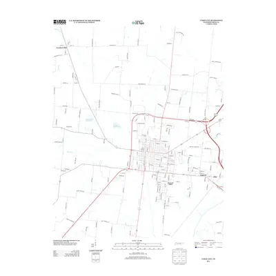
2013 Map of Union City
USGS Topo · Published 2013About this map
The residential street grids and agricultural surroundings of Obion County are documented in this 2013 topographic survey. The area's hydrology is defined by the winding paths of N Reelfoot Cr and Hoosier Cr, with water management evidenced by the Houser Creek Dam and Mockingbird Hills Lake. The settlement pattern shows a concentration of infrastructure around the city center, transitioning into smaller outlying communities such as Woodland Mills, Pleasant Valley, and Highland. The road network is dense, featuring a mix of established local streets like Cedar St and rural routes such as Walker Tanner Rd and Salem Church Rd. These roads often bear the names of local families and historic landmarks, providing a clear view of the county's physical development and its connection to the surrounding West Tennessee landscape near Gibbs.
Find a feature on this map
148 named features on this map. Tap any name to fly to it.
Don’t see what you’re looking for? This feature index may not catch every label — zoom into the map to look around manually.
Map Details
Editions of this 2013 Union City Map
This is the sole edition of this map. No revisions or reprints were ever made.
Other maps of this area

1939 · Hickman
USGS Topo · 1:62,500

1950 · Obion
USGS Topo · 1:24,000

1950 · Rives
USGS Topo · 1:24,000

1951 · Obion
USGS Topo · 1:24,000

1951 · Rives
USGS Topo · 1:24,000

1951 · Cayce
USGS Topo · 1:24,000

1951 · Hickman
USGS Topo · 1:24,000

1952 · Crutchfield
USGS Topo · 1:24,000

1952 · Water Valley
USGS Topo · 1:62,500

1954 · Union City
USGS Topo · 1:24,000