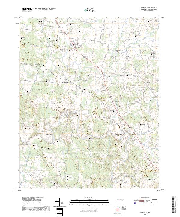
2022 Map of Unionville
USGS Topo · Published 2022About this map
Unionville and its surrounding Bedford County hamlets define the landscape of this Central Tennessee region, where a dense network of family-named cemeteries and rural crossroads speaks to generations of local settlement. The terrain is marked by the winding course of the Duck River, which carves distinctive features such as Shearin Bend and the prominent Tarpley Bluff. This area historically relied on the water power of the regional creeks, evidenced by landmarks like Anchor Mill and the community at Halls Mill.
Find a feature on this map
142 named features on this map. Tap any name to fly to it.
Don’t see what you’re looking for? This feature index may not catch every label — zoom into the map to look around manually.
Map Details
Editions of this 2022 Unionville Map
This is the sole edition of this map. No revisions or reprints were ever made.
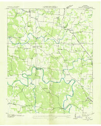
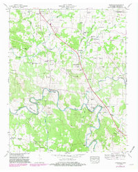
Historical Maps of Anchor Mill Through Time
3 maps found