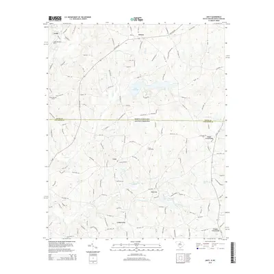
2014 Map of Unity
USGS Topo · Published 2014About this map
Unity and its surrounding countryside bridge the state line between North Carolina and South Carolina, defined by a landscape of creek-fed ponds and small airfields. Water management is a visible priority across the terrain, with several engineered features like the Cane Cr Watershed Site Seven and Cane Cr Watershed Site 16 indicating modern flood control efforts along Cane Cr. Private aviation also marks the area, seen at the Unity Aerodrome and the Jaars facility in the northwest.
Find a feature on this map
134 named features on this map. Tap any name to fly to it.
Don’t see what you’re looking for? This feature index may not catch every label — zoom into the map to look around manually.
Map Details
Editions of this 2014 Unity Map
This is the sole edition of this map. No revisions or reprints were ever made.
Other maps of this area

1941 · Spartanburg
USGS Topo · 1:250,000

1953 · Spartanburg
USGS Topo · 1:250,000

1960 · Spartanburg
USGS Topo · 1:250,000

1963 · Spartanburg
USGS Topo · 1:250,000

1964 · Spartanburg
USGS Topo · 1:250,000

1968 · Van Wyck
USGS Topo · 1:24,000
1968 · Catawba NE
USGS Topo · 1:24,000

1969 · Antioch
USGS Topo · 1:24,000
1969 · Lancaster
USGS Topo · 1:24,000
1969 · Taxahaw
USGS Topo · 1:24,000