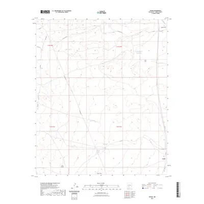
2023 Map of Upham
USGS Topo · Published 2023About this map
Upham stands as a focal point in this high-desert landscape of Sierra County, where the infrastructure of ranching and resource extraction meets the natural drainage systems of the Rio Grande basin. The terrain is defined by a series of significant seasonal watercourses, including Aleman Draw in the north and Barbee Draw at the southern edge, which carve through the land near the Canon Avendijo. A complex network of roads like Aleman Shortcut and Co RD A-13 provide access across the townships. This 2023 survey documents the specialized water management essential for the region, noted by features such as Rabbit Tank and Highline Tank. Of particular historical interest to researchers of the local energy industry is the long-named Sun Ray Midcontinent New Mexico Federal M Number 1 Spring, reflecting decades of land use and mineral exploration.
Find a feature on this map
26 named features on this map. Tap any name to fly to it.
Don’t see what you’re looking for? This feature index may not catch every label — zoom into the map to look around manually.
Map Details
Editions of this 2023 Upham Map
This is the sole edition of this map. No revisions or reprints were ever made.
Other maps of this area

1916 · Tonuco
USGS Topo · 1:125,000

1916 · Salinas Peak
USGS Topo · 1:125,000

1932 · Tonuco
USGS Topo · 1:125,000

1948 · Sowell
USGS Topo · 1:62,500

1948 · Chicken Well
USGS Topo · 1:62,500

1954 · Tularosa
USGS Topo · 1:250,000

1955 · Las Cruces
USGS Topo · 1:250,000

1958 · Las Cruces
USGS Topo · 1:250,000

1958 · Tularosa
USGS Topo · 1:250,000

1959 · Engle
USGS Topo · 1:62,500