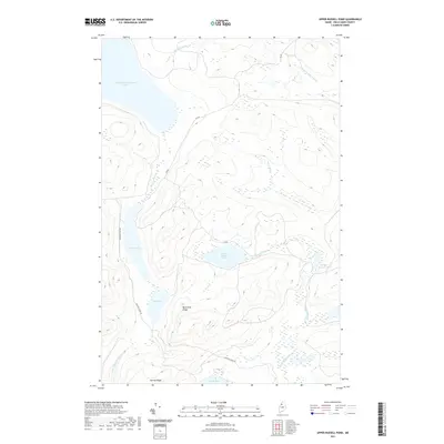
2021 Map of Upper Russell Pond
USGS Topo · Published 2021About this map
Upper Russell Pond and the surrounding backcountry of Piscataquis County are defined by an intricate network of waterways and glacial ridges in this modern survey. The landscape is structured by prominent elevations like Mud Pond Ridge and Narrow Ridge, which guide the flow of various tributaries toward larger bodies of water. Significant basins including Chemquasabamticook Lake and Crescent Pond dominate the western portion of the quadrangle, while the eastern section is drained by the S Br Russell Brook and Snare Brook. This area represents a managed forest landscape, where access is provided primarily by unimproved routes such as Cyr Rd and Narrow Ridge Rd. The drainage pattern is complex, with the E Br Allagash Stream and Gannett Brook illustrating the region's role as a vital headwater territory in Northern Maine.
Find a feature on this map
18 named features on this map. Tap any name to fly to it.
Don’t see what you’re looking for? This feature index may not catch every label — zoom into the map to look around manually.
Map Details
Editions of this 2021 Upper Russell Pond Map
This is the sole edition of this map. No revisions or reprints were ever made.
Other maps of this area

1932 · Umsaskis Lake
USGS Topo · 1:48,000

1935 · Umsaskis Lake
USGS Topo · 1:62,500

1954 · Churchill Lake
USGS Topo · 1:62,500

1954 · Allagash Lake
USGS Topo · 1:62,500

1954 · Presque Isle
USGS Topo · 1:250,000

1955 · Clayton Lake
USGS Topo · 1:62,500

1958 · Presque Isle
USGS Topo · 1:250,000

1960 · Presque Isle
USGS Topo · 1:250,000

1961 · Allagash Lake
USGS Topo · 1:62,500
1962 · Churchill Lake
USGS Topo · 1:62,500