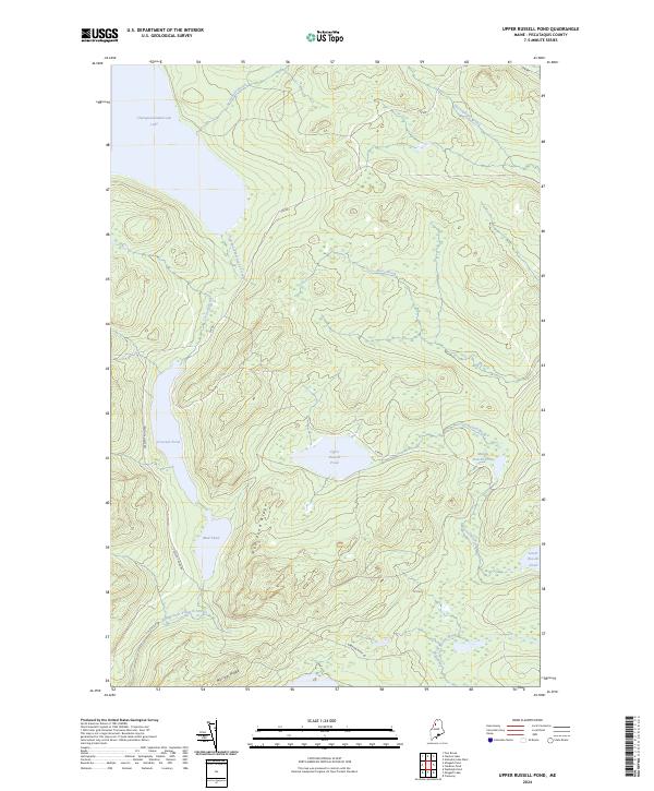
2024 Map of Upper Russell Pond
USGS Topo · Published 2024About this map
Chemquasabamticook Lake and its surrounding watershed dominate this portion of the North Maine Woods, a landscape defined by an intricate network of glacial ponds and drainage streams. The map traces the headwaters of the East Branch Allagash Stream, illustrating the interconnected nature of the regional hydrology through names like Upper Russell Pond, Middle Russell Pond, and Lower Russell Pond. These water bodies are hemmed in by prominent local elevations such as Mud Pond Ridge and Narrow Ridge. Modern access into this remote timberland is documented via primitive routes like Cyr Rd and Crescent Pond Rd, which wind through the dense forest and around the marshes of Mud Pond. The survey highlights the characteristic drainage patterns of the northern wilderness, where brooks like Snare Brook and Gannett Brook feed into larger lake systems.
Find a feature on this map
18 named features on this map. Tap any name to fly to it.
Don’t see what you’re looking for? This feature index may not catch every label — zoom into the map to look around manually.
Map Details
Editions of this 2024 Upper Russell Pond Map
This is the sole edition of this map. No revisions or reprints were ever made.
Other maps of this area

1932 · Umsaskis Lake
USGS Topo · 1:48,000

1935 · Umsaskis Lake
USGS Topo · 1:62,500

1954 · Churchill Lake
USGS Topo · 1:62,500

1954 · Allagash Lake
USGS Topo · 1:62,500

1954 · Presque Isle
USGS Topo · 1:250,000

1955 · Clayton Lake
USGS Topo · 1:62,500

1958 · Presque Isle
USGS Topo · 1:250,000

1960 · Presque Isle
USGS Topo · 1:250,000

1961 · Allagash Lake
USGS Topo · 1:62,500
1962 · Churchill Lake
USGS Topo · 1:62,500