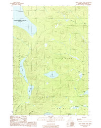
1989 Map of Upper Russell Pond
USGS Topo · Published 1989About this map
Chemquasabamticook Lake (Ross Lake) dominates the northwestern corner of this remote Maine landscape, where the interconnected waterways of the Allagash region define the terrain. The map captures a complex network of seasonal brooks and glacial ponds, including the distinct chain of Middle Russell Pond, Lower Russell Pond, and Upper Russell Pond. Unlike more settled regions, the area is defined by its industrial and recreational utility, shown through the presence of a Shale Pit and a remote Campground near the shores of Crescent Pond. The surveying reveals the precise boundaries of several townships, such as T 9 R 14 Wels, providing a clear view of the logging and land management grid system in the late 20th century. Prominent landforms like Mud Pond Ridge and Narrow Ridge separate the various watersheds, including the First South Branch Russell Pond and the headwaters of the E Br Allagash Stream.
Find a feature on this map
26 named features on this map. Tap any name to fly to it.
Don’t see what you’re looking for? This feature index may not catch every label — zoom into the map to look around manually.
Map Details
Editions of this 1989 Upper Russell Pond Map
This is the sole edition of this map. No revisions or reprints were ever made.
Other maps of this area

1932 · Umsaskis Lake
USGS Topo · 1:48,000

1935 · Umsaskis Lake
USGS Topo · 1:62,500

1954 · Churchill Lake
USGS Topo · 1:62,500

1954 · Allagash Lake
USGS Topo · 1:62,500

1954 · Presque Isle
USGS Topo · 1:250,000

1955 · Clayton Lake
USGS Topo · 1:62,500

1958 · Presque Isle
USGS Topo · 1:250,000

1960 · Presque Isle
USGS Topo · 1:250,000

1961 · Allagash Lake
USGS Topo · 1:62,500
1962 · Churchill Lake
USGS Topo · 1:62,500