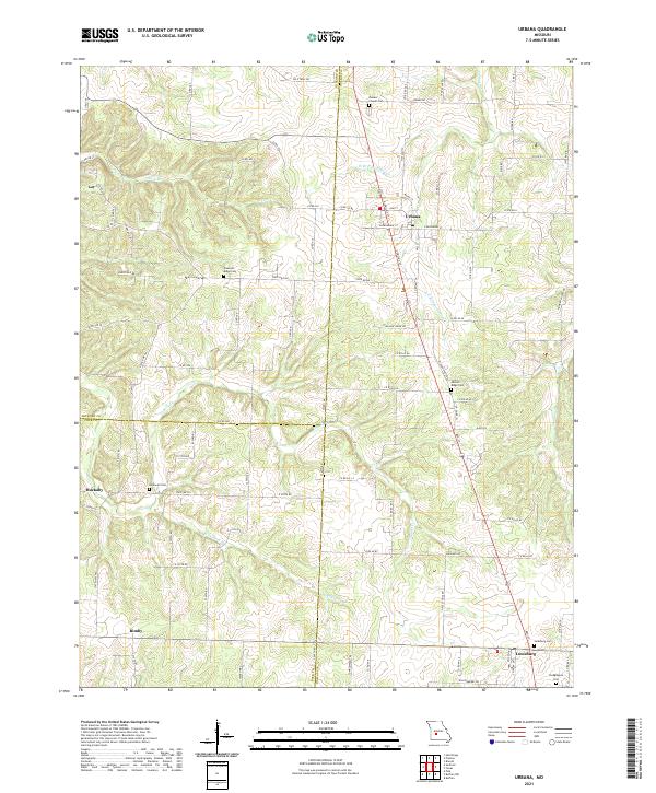
2021 Map of Urbana
USGS Topo · Published 2021About this map
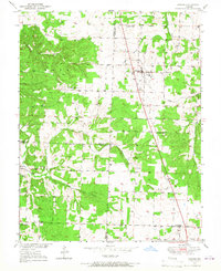
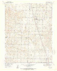
Urbana and Louisburg anchor this segment of the Ozark foothills, where the boundaries of Hickory, Polk, and Dallas counties meet. The landscape is defined by the branching tributaries of Cahoochie Creek, including the West Branch and East Branch, which carve through the undulating terrain alongside Ingalls Creek and Wilkinson Branch. This area has long served as a crossroads for rural communities, evidenced by the cluster of burial grounds that preserve local family names, such as Bowers Chapel Cemetery and Crudgington Cemetery. Smaller settlements like Huckaby and Rimby are situated along a network of state highways and county roads that follow the ridges between these creek valleys. The arrangement of farmsteads and the orientation of routes like State Highway HH reflect the enduring agricultural character of this Missouri interior.
Find a feature on this map
98 named features on this map. Tap any name to fly to it.
Don’t see what you’re looking for? This feature index may not catch every label — zoom into the map to look around manually.
Map Details
Editions of this 2021 Urbana Map
This is the sole edition of this map. No revisions or reprints were ever made.