2022 Map of Ute
USGS Topo · Published 2022About this map
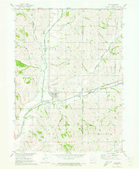
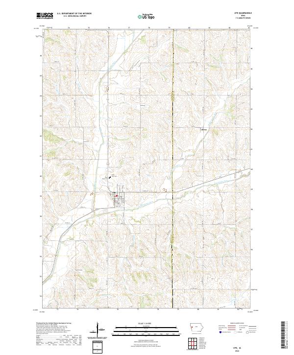
Ute serves as the central hub of this Western Iowa landscape, where the confluence of several waterways shaped the local development. The town is situated near the junction of the Soldier River and the East Soldier River, a drainage system that defines the local topography of ridges and valleys. To the north, the small settlement of Berne sits along the Middle Soldier River, reflecting the historically dispersed nature of rural communities in this region. Local heritage is preserved at sites like Saint Clair Cem and Saint Marys Cem, located just north of the main township. The map reveals a grid of rural routes such as Co Hwy E34 and 190th St that navigate around numerous tributaries including Skunk Cr, Rush Cr, and Rock Cr. This area on the Monona County and Crawford County border maintains its character as a river-valley agricultural corridor.
Find a feature on this map
55 named features on this map. Tap any name to fly to it.
Don’t see what you’re looking for? This feature index may not catch every label — zoom into the map to look around manually.
Map Details
Editions of this 2022 Ute Map
This is the sole edition of this map. No revisions or reprints were ever made.