
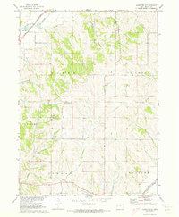
1971 Map of Ute
USGS Topo · Published 1973About this map
The Soldier River and its multiple branches define the drainage patterns of this western Iowa landscape, where the town of Ute sits at the convergence of several major valleys. This 1971 aerial-photogrammetric survey captures the area’s agricultural and transportation backbone, anchored by the Chicago Milwaukee St Paul and Pacific railroad line. The rail corridor follows the river valley through the village of Berne, providing a crucial link for the region's grain-based economy. For those researching family history in Monona and Crawford counties, the map identifies several local burial grounds including St Marys Cem, St Clairce Cem, and Putman Cem. The terrain is deeply dissected by numerous tributaries like Rush Creek and Willow Creek, creating the distinct ridge-and-valley topography characteristic of the Loess Hills region.
Find a feature on this map
19 named features on this map. Tap any name to fly to it.
Don’t see what you’re looking for? This feature index may not catch every label — zoom into the map to look around manually.
Map Details
Editions of this 1971 Ute Map
This is the sole edition of this map. No revisions or reprints were ever made.
Other maps of this area

1954 · Omaha
USGS Topo · 1:250,000

1954 · Fort Dodge
USGS Topo · 1:250,000

1957 · Omaha
USGS Topo · 1:250,000

1957 · Fort Dodge
USGS Topo · 1:250,000

1958 · Omaha
USGS Topo · 1:250,000

1958 · Fort Dodge
USGS Topo · 1:250,000

1969 · Danbury
USGS Topo · 1:24,000

1969 · Mapleton
USGS Topo · 1:24,000
1971 · Mapleton SE
USGS Topo · 1:24,000

1971 · Ricketts
USGS Topo · 1:24,000