
1971 Map of Ricketts
USGS Topo · Published 1973About this map
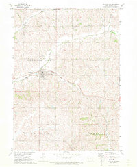
Ricketts serves as the focal point of this western Iowa landscape, where the town's small-scale layout is clearly defined by its central Park and the local Immanuel Ch. The terrain is deeply tied to the drainage systems of the Soldier River and Beaver Creek, which cut across the townships of Garfield, Grant, Soldier, and Morgan. Of particular interest to historians is the Old Railroad Grade that winds through the southern portion of the quadrangle, marking the path of a former transportation corridor through Crawford County. The map also captures infrastructure critical to the local economy and community, such as a Gravel Pit near the riverbanks and a Sewage Disp facility. This topography reflects a late twentieth-century agricultural environment shaped by both natural watercourses like the Middle Soldier River and the enduring imprint of early rail infrastructure.
Find a feature on this map
15 named features on this map. Tap any name to fly to it.
Don’t see what you’re looking for? This feature index may not catch every label — zoom into the map to look around manually.
Map Details
Editions of this 1971 Ricketts Map
This is the sole edition of this map. No revisions or reprints were ever made.
Other maps of this area

1954 · Fort Dodge
USGS Topo · 1:250,000

1957 · Fort Dodge
USGS Topo · 1:250,000

1958 · Fort Dodge
USGS Topo · 1:250,000

1967 · Ida Grove
USGS Topo · 1:24,000

1967 · Battle Creek
USGS Topo · 1:24,000

1969 · Danbury
USGS Topo · 1:24,000

1969 · Holstein SW
USGS Topo · 1:24,000

1971 · Ute
USGS Topo · 1:24,000

1971 · Schleswig
USGS Topo · 1:24,000
1971 · Charter Oak
USGS Topo · 1:24,000