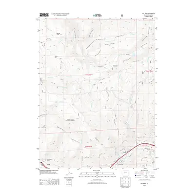
2013 Map of Vail West
USGS Topo · Published 2013About this map
White River National Forest defines the rugged verticality of this 2013 survey, where high-altitude parks like Moniger Park and Flagstone Park sit amidst a complex network of drainage basins. The landscape is carved by the Piney River and East Meadow Creek, flowing through deep gulches and valleys toward the settled areas in the south. The transition from the wilderness of Red and White Mountain to the developed corridors of the Eagle Valley is sharp, marked by the presence of the Vail Ski Area and the communities of Avon and West Vail. This map illustrates the vital intersection of recreation and geography, with numerous named trails such as the Lake To Piney Trail and Buck Creek Trail providing access to remote points like Piney Lake and the Piney Crossing Campground. Local water management is represented by the Nottingham Reservoir and various creeks like Swift Gulch and Middle Creek that feed the Gore Creek watershed.
Find a feature on this map
67 named features on this map. Tap any name to fly to it.
Don’t see what you’re looking for? This feature index may not catch every label — zoom into the map to look around manually.
Map Details
Editions of this 2013 Vail West Map
This is the sole edition of this map. No revisions or reprints were ever made.
Other maps of this area

1933 · Mt. Powell
USGS Topo · 1:48,000

1934 · Minturn
USGS Topo · 1:62,500

1940 · Mount Powell
USGS Topo · 1:62,500

1950 · Minturn
USGS Topo · 1:62,500

1957 · Leadville
USGS Topo · 1:250,000

1959 · Leadville
USGS Topo · 1:250,000

1960 · Leadville
USGS Topo · 1:250,000

1962 · Leadville
USGS Topo · 1:250,000

1962 · Grouse Mountain
USGS Topo · 1:24,000

1962 · Edwards
USGS Topo · 1:24,000