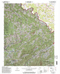
1994 Map of Valle Crucis
USGS Topo · Published 1998About this map
The Watauga River winds through the high country of the Blue Ridge in this mid-1990s revision, which details the historic community of Valle Crucis. The landscape is defined by the sharp elevations of Beech Mountain and Grandfather Mountain, with the Pisgah National Forest boundary cutting across the central ridges. Local religious life is well-documented through numerous small congregations, including the Holy Cross Church and St Anthony Church, while family legacies are preserved in the Farthing Cemetery and Mast Cemetery.
Find a feature on this map
86 named features on this map. Tap any name to fly to it.
Don’t see what you’re looking for? This feature index may not catch every label — zoom into the map to look around manually.
Map Details
Editions of this 1994 Valle Crucis Map
This is the sole edition of this map. No revisions or reprints were ever made.
Other maps of this area

1893 · Cranberry
USGS Topo · 1:125,000

1895 · Cranberry
USGS Topo · 1:125,000

1899 · Cranberry
USGS Topo · 1:125,000

1902 · Cranberry
USGS Topo · 1:125,000

1934 · Valle Crucis
USGS Topo · 1:24,000

1934 · Elk Park
USGS Topo · 1:24,000

1934 · Boone
USGS Topo · 1:24,000

1934 · Newland
USGS Topo · 1:24,000

1935 · Doe Mountain
USGS Topo · 1:48,000

1935 · Sherwood
USGS Topo · 1:24,000