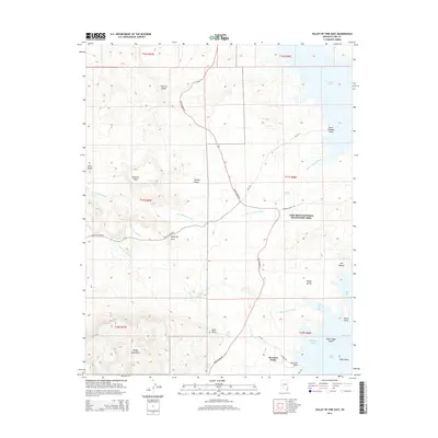
2014 Map of Valley of Fire East
USGS Topo · Published 2014About this map
The Mojave Desert terrain meets the northern reaches of Lake Mead in this study of the eastern portion of the Lake Mead National Recreation Area. The landscape is defined by the convergence of dramatic geological formations like Overton Ridge, Silica Dome, and the Muddy Mountains with the rising waters of the Virgin Basin. Isolated water sources such as Blue Point Spring, Rogers Spring, and Getchel Spring highlight the critical role of desert springs in an area dominated by dry washes like Saint Thomas Wash and Valley of Fire Wash. Access to the shoreline at Stewarts Point and Saint Thomas Point is facilitated by Northshore Rd, which winds through the basin toward the prominent landmark of Elephant Rock.
Find a feature on this map
35 named features on this map. Tap any name to fly to it.
Don’t see what you’re looking for? This feature index may not catch every label — zoom into the map to look around manually.
Map Details
Editions of this 2014 Valley of Fire East Map
This is the sole edition of this map. No revisions or reprints were ever made.
Other maps of this area

1886 · Saint Thomas
USGS Topo · 1:250,000

1893 · Saint Thomas
USGS Topo · 1:250,000

1926 · Bonelli
USGS Topo · 1:96,000

1926 · Boulder Canyon
USGS Topo · 1:96,000

1953 · Muddy Peak
USGS Topo · 1:62,500

1953 · Overton Beach
USGS Topo · 1:62,500

1954 · Las Vegas
USGS Topo · 1:250,000

1957 · Las Vegas
USGS Topo · 1:250,000

1958 · Moapa
USGS Topo · 1:62,500

1958 · Overton
USGS Topo · 1:62,500