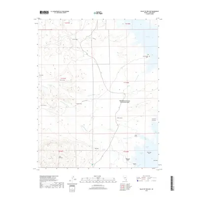
2018 Map of Valley of Fire East
USGS Topo · Published 2018About this map
Lake Mead and its desert shoreline define this landscape, where the waters of the Overton Arm meet the Virgin Basin. This desert terrain is characterized by complex geological formations and intermittent watercourses like Saint Thomas Wash and Valley of Fire Wash. Notable landmarks such as Elephant Rock and Silica Dome stand out against the Baseline Mesa, marking a region known for its unique natural sculptures. Rare water sources are found at Rogers Spring, Blue Point Spring, and Getchel Spring, providing vital points of interest in an otherwise arid environment. The presence of Stewarts Point and Saint Thomas Point along the lake's edge highlights the relationship between the rising reservoir levels and the surrounding Mojave Desert terrain. The map also traces the Valley of Fire Hwy, which serves as the primary artery through the Lake Mead National Recreation Area.
Find a feature on this map
35 named features on this map. Tap any name to fly to it.
Don’t see what you’re looking for? This feature index may not catch every label — zoom into the map to look around manually.
Map Details
Editions of this 2018 Valley of Fire East Map
This is the sole edition of this map. No revisions or reprints were ever made.
Other maps of this area

1886 · Saint Thomas
USGS Topo · 1:250,000

1893 · Saint Thomas
USGS Topo · 1:250,000

1926 · Bonelli
USGS Topo · 1:96,000

1926 · Boulder Canyon
USGS Topo · 1:96,000

1953 · Muddy Peak
USGS Topo · 1:62,500

1953 · Overton Beach
USGS Topo · 1:62,500

1954 · Las Vegas
USGS Topo · 1:250,000

1957 · Las Vegas
USGS Topo · 1:250,000

1958 · Moapa
USGS Topo · 1:62,500

1958 · Overton
USGS Topo · 1:62,500