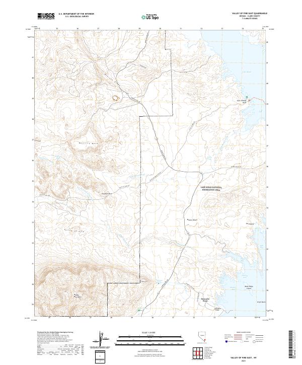
2021 Map of Valley of Fire East
USGS Topo · Published 2021About this map
Lake Mead National Recreation Area dominates the eastern landscape of this Nevada survey, where the waters of the Overton Arm meet the northern reaches of Virgin Basin. This desert environment is defined by its dramatic geologic formations, including the red sandstone of Valley of Fire and the distinctive Elephant Rock. To the west, the Muddy Mountains rise against the Baseline Mesa and Overton Ridge, providing a stark contrast to the riparian pockets found at Rogers Spring and Blue Point Spring.
Find a feature on this map
41 named features on this map. Tap any name to fly to it.
Don’t see what you’re looking for? This feature index may not catch every label — zoom into the map to look around manually.
Map Details
Editions of this 2021 Valley of Fire East Map
This is the sole edition of this map. No revisions or reprints were ever made.
Other maps of this area

1886 · Saint Thomas
USGS Topo · 1:250,000

1893 · Saint Thomas
USGS Topo · 1:250,000

1926 · Bonelli
USGS Topo · 1:96,000

1926 · Boulder Canyon
USGS Topo · 1:96,000

1953 · Muddy Peak
USGS Topo · 1:62,500

1953 · Overton Beach
USGS Topo · 1:62,500

1954 · Las Vegas
USGS Topo · 1:250,000

1957 · Las Vegas
USGS Topo · 1:250,000

1958 · Moapa
USGS Topo · 1:62,500

1958 · Overton
USGS Topo · 1:62,500