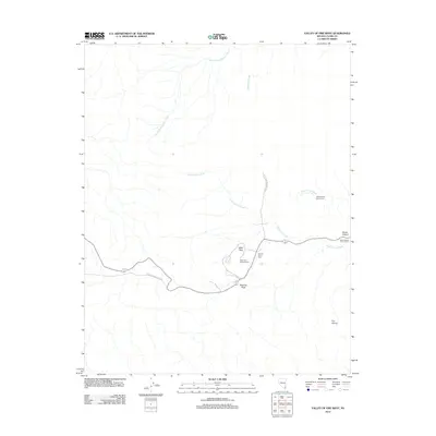
2012 Map of Valley of Fire West
USGS Topo · Published 2012About this map
Valley of Fire State Park preserves a landscape of red sandstone formations and ancient geologic history within Clark County. The terrain is defined by dry drainage systems such as South Fork Overton Wash and Valley of Fire Wash, which have carved out notable landmarks like Atlatl Rock and Beehive Rock. This 2012 survey details the modern infrastructure supporting recreation in the park, including the Atlatl Rock Campground and several designated sites like the Sunrise Picnic Area and Mouses Tank Picnic Area. The spatial distribution of features such as Seven Sisters and Fire Alcove highlights the accessibility of these distinctive formations via the primary road network cutting through the desert floor.
Find a feature on this map
13 named features on this map. Tap any name to fly to it.
Don’t see what you’re looking for? This feature index may not catch every label — zoom into the map to look around manually.
Map Details
Editions of this 2012 Valley of Fire West Map
This is the sole edition of this map. No revisions or reprints were ever made.
Other maps of this area

1886 · Saint Thomas
USGS Topo · 1:250,000

1893 · Saint Thomas
USGS Topo · 1:250,000

1926 · Bonelli
USGS Topo · 1:96,000

1926 · Boulder Canyon
USGS Topo · 1:96,000

1953 · Muddy Peak
USGS Topo · 1:62,500

1953 · Overton Beach
USGS Topo · 1:62,500

1954 · Las Vegas
USGS Topo · 1:250,000

1957 · Las Vegas
USGS Topo · 1:250,000

1958 · Moapa
USGS Topo · 1:62,500

1958 · Overton
USGS Topo · 1:62,500