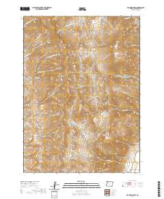
2020 Map of Van Horn Basin
USGS Topo · Published 2020About this map
The high desert reaches of the Pueblo Mountains dominate this Harney County landscape, where elevation changes define a series of distinct basins and alpine meadows. The eastern slopes of these peaks descend toward Denio Basin and Monument Basin, providing a sharp vertical contrast typical of the Great Basin geography. Genealogists and local historians can find the Denio Cem situated in the southeastern corner near the intersection of the modern Fields Denio Rd, marking a point of long-standing human presence in this sparsely populated region. Seasonal water sources are scattered throughout the highlands, including Mapes Springs and drainage systems like Van Horn Cr and Cherry Cr. Named features such as Propeller Meadows and Ten Cent Meadows indicate a history of local land use, while Van Horn Basin provides a central landmark for this high-altitude survey.
Find a feature on this map
34 named features on this map. Tap any name to fly to it.
Don’t see what you’re looking for? This feature index may not catch every label — zoom into the map to look around manually.
Map Details
Editions of this 2020 Van Horn Basin Map
This is the sole edition of this map. No revisions or reprints were ever made.
Other maps of this area

1886 · Disaster
USGS Topo · 1:250,000

1893 · Disaster
USGS Topo · 1:250,000

1954 · Vya
USGS Topo · 1:250,000

1955 · Adel
USGS Topo · 1:250,000

1957 · Adel
USGS Topo · 1:250,000

1958 · Vya
USGS Topo · 1:250,000

1958 · Adel
USGS Topo · 1:250,000

1962 · Vya
USGS Topo · 1:250,000

1962 · Adel
USGS Topo · 1:250,000

1965 · Railroad Point
USGS Topo · 1:62,500