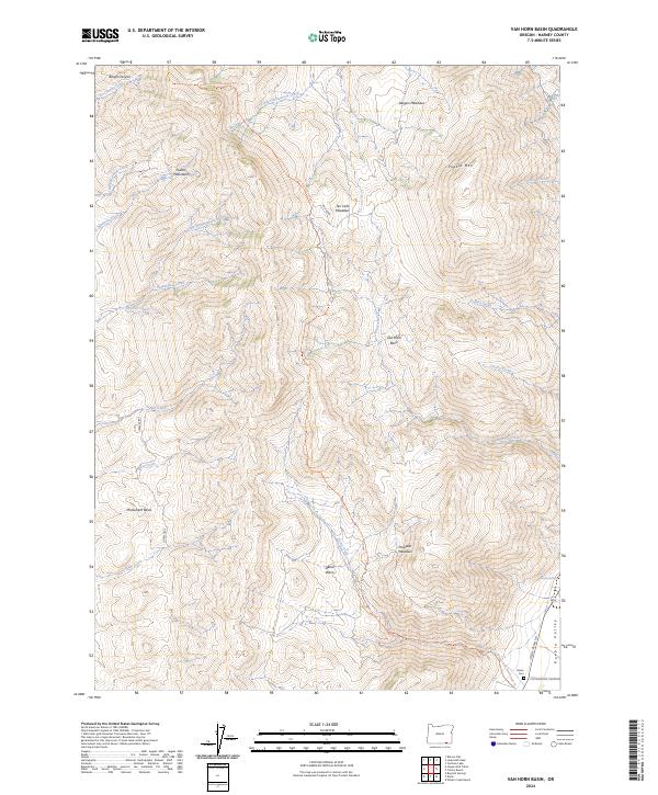
2024 Map of Van Horn Basin
USGS Topo · Published 2024About this map
Pueblo Mountains dominate this high-desert landscape in Harney County, Oregon, where sharp relief gives way to the broad Pueblo Valley in the southeast. This modern survey illustrates the complex drainage systems of the region, featuring numerous seasonal waterways like Little Stonehouse Creek, Crickett Creek, and Van Horn Creek that flow toward the lower basins. The southern portion of the sheet provides valuable genealogical context at the Denio Cem, situated near the intersection of Fields-Denio Rd and Cottonwood-Fields Rd.
Find a feature on this map
34 named features on this map. Tap any name to fly to it.
Don’t see what you’re looking for? This feature index may not catch every label — zoom into the map to look around manually.
Map Details
Editions of this 2024 Van Horn Basin Map
This is the sole edition of this map. No revisions or reprints were ever made.
Other maps of this area

1886 · Disaster
USGS Topo · 1:250,000

1893 · Disaster
USGS Topo · 1:250,000

1954 · Vya
USGS Topo · 1:250,000

1955 · Adel
USGS Topo · 1:250,000

1957 · Adel
USGS Topo · 1:250,000

1958 · Vya
USGS Topo · 1:250,000

1958 · Adel
USGS Topo · 1:250,000

1962 · Vya
USGS Topo · 1:250,000

1962 · Adel
USGS Topo · 1:250,000

1965 · Railroad Point
USGS Topo · 1:62,500