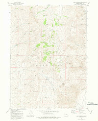
1981 Map of Van Horn Basin
USGS Topo · Published 1981About this map
Pueblo Mountains dominate this high-desert landscape in Harney County, where steep drainages like Cottonwood Creek and Stonehouse Creek carve through the massif. The map documents a sparsely populated ranching and mining region during the late 1970s, evidenced by isolated structures such as the O'Connor Homestead and Tiller Cabin. The settlement of Denio sits at the southern edge of the basin near Pueblo Valley Creek, serving as a local hub for the surrounding livestock operations and mining interests.
Find a feature on this map
34 named features on this map. Tap any name to fly to it.
Don’t see what you’re looking for? This feature index may not catch every label — zoom into the map to look around manually.
Map Details
Editions of this 1981 Van Horn Basin Map
This is the sole edition of this map. No revisions or reprints were ever made.
Other maps of this area

1886 · Disaster
USGS Topo · 1:250,000

1893 · Disaster
USGS Topo · 1:250,000

1954 · Vya
USGS Topo · 1:250,000

1955 · Adel
USGS Topo · 1:250,000

1957 · Adel
USGS Topo · 1:250,000

1958 · Vya
USGS Topo · 1:250,000

1958 · Adel
USGS Topo · 1:250,000

1962 · Vya
USGS Topo · 1:250,000

1962 · Adel
USGS Topo · 1:250,000

1965 · Railroad Point
USGS Topo · 1:62,500